World War II era
Height 17” Width 16 1/2”
Provenance: Bishop Museum Honolulu, HI
The Marshall Islands in eastern Micronesia consist of thirty-four coral atolls consisting of more than one thousand islands and islets spread out across an area of several hundred miles. In order to maintain links between the islands, the Marshall Islanders built seafaring canoes. These vessels were both quick and maneuverable. The islanders developed a reputation for navigation between the islands—not a simple matter, since they are all so low that none can be seen from more than a few miles away.
In order to determine a system of piloting and navigation the islanders devised charts that marked not only the locations of the islands, but their knowledge of the swell and wave patterns as well. The charts were composed of wooden stick such as in this example; the horizontal and vertical sticks act as supports, while diagonal and curved ones represent wave swells. Cowrie or other small shells represent the position of the islands. The information was memorized and the charts would not be carried on voyages.
INQUIRE HERE

 Image 1 of 6
 Image 2 of 6
 Image 3 of 6
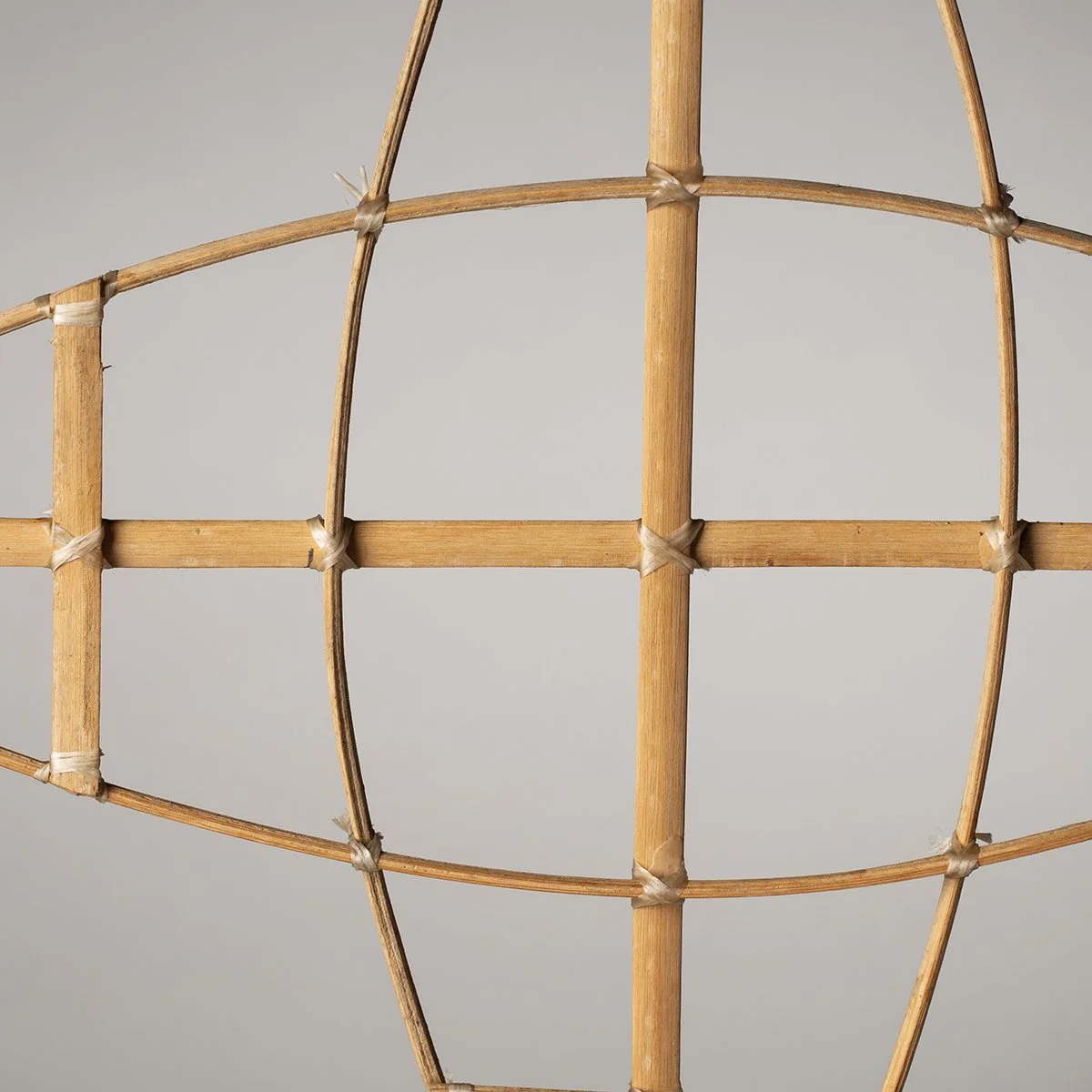 Image 4 of 6
 Image 5 of 6
 Image 6 of 6