
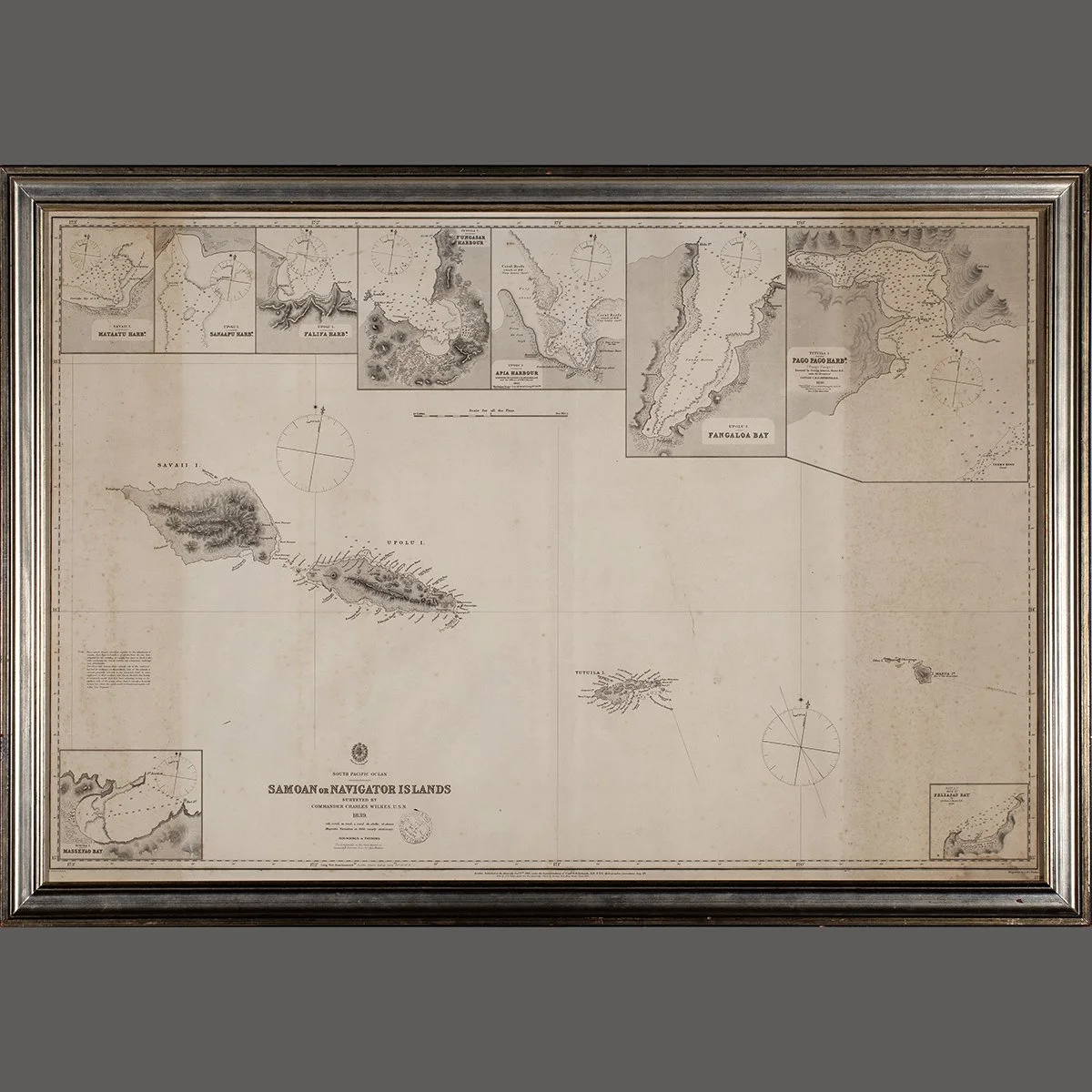
 Image 1 of 3
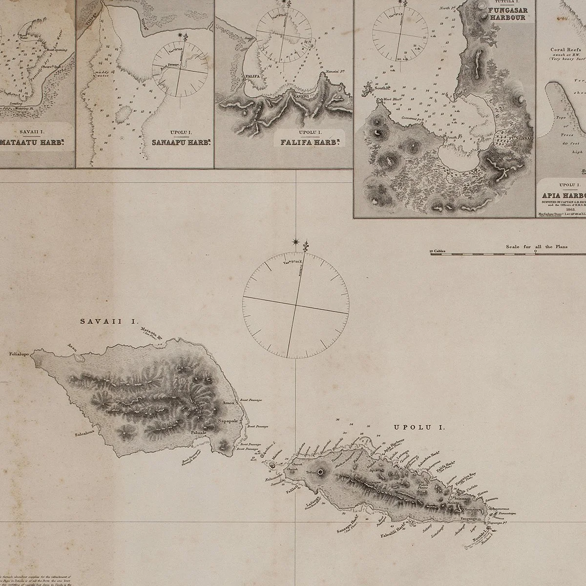 Image 2 of 3
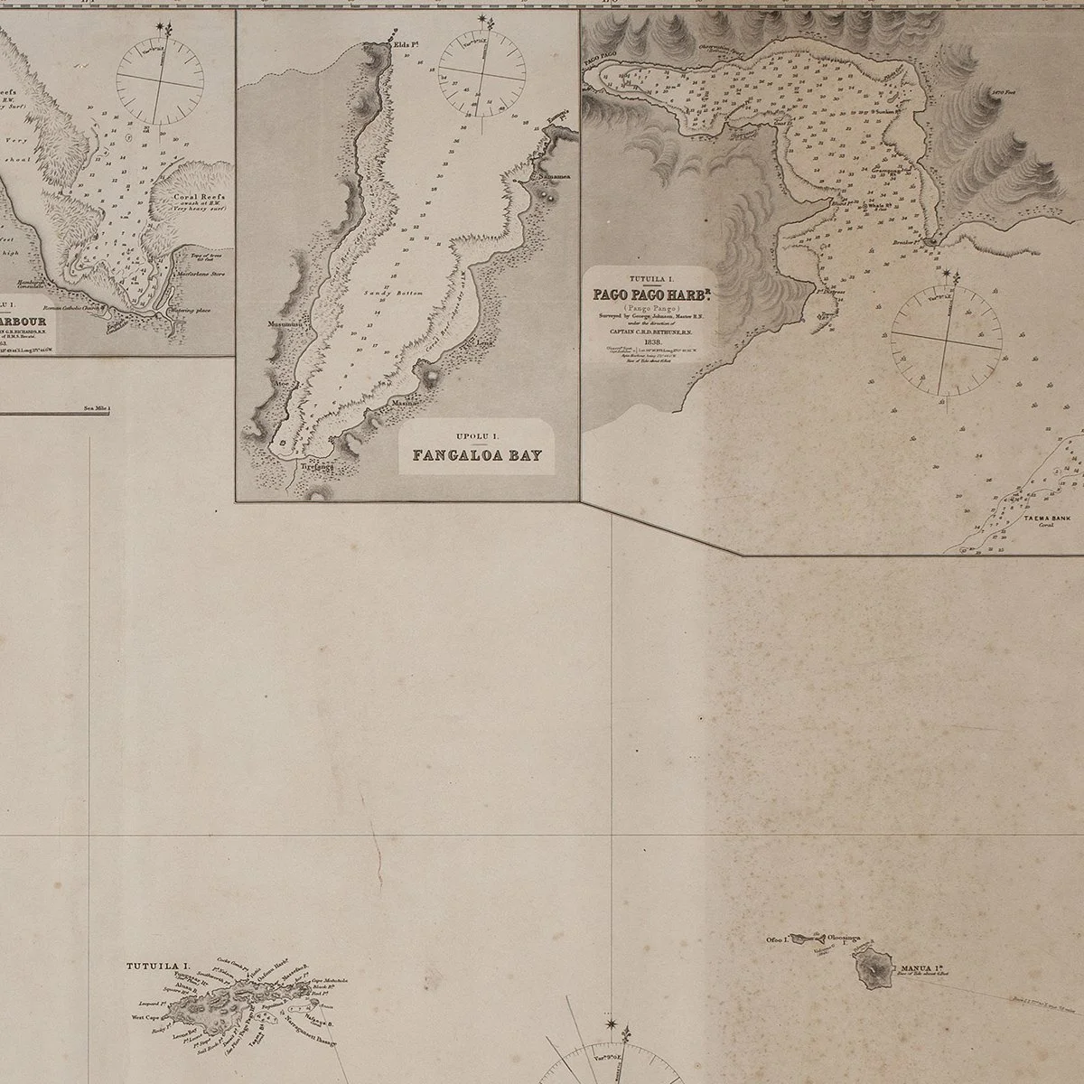 Image 3 of 3
Charles Wilkes Commander USN
1866
Published the Admiralty Oct 3, 1866 under the supervision of Capt G. H. Richards Hydrographer
Height 29 1/2" Width 42"
Provenance: Donald Stanley Marshall, Salem, MA
The most important large and detailed map ever published on the islands of Samoa. This map hung is the noted Pacific scholar in his office at the Peabody Museum. Rare.